Radar Integrated Data Environment
Production-grade
4D Imaging Radar dataset,
captured by AIR4D (AFI920).
A 4D Imaging Radar dataset curated and verified by the sensor manufacturer — real-world measurements, not synthetic data. Built for perception development, validation, and benchmarking.
01 — Dataset
A 4D Imaging Radar dataset, ready to use.
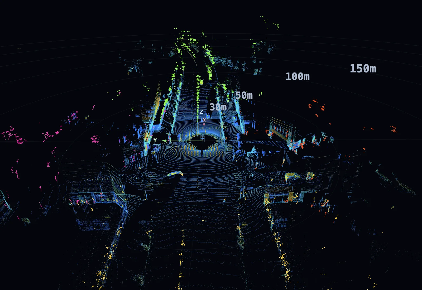
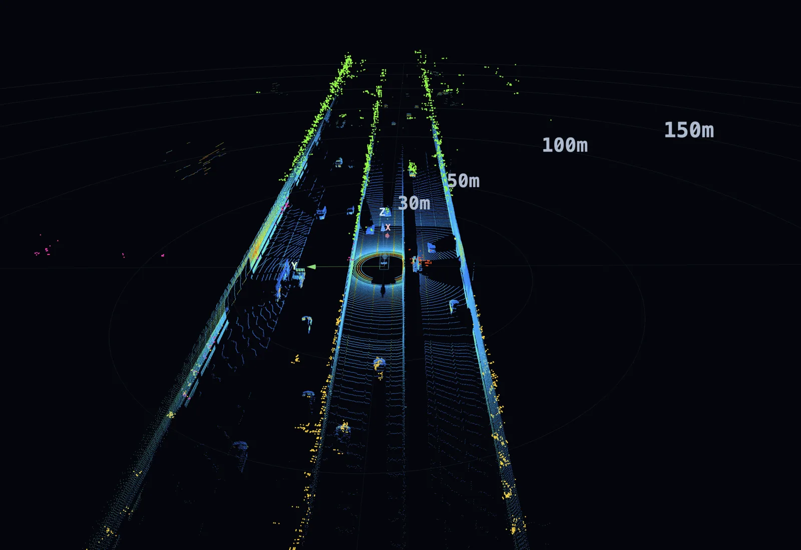
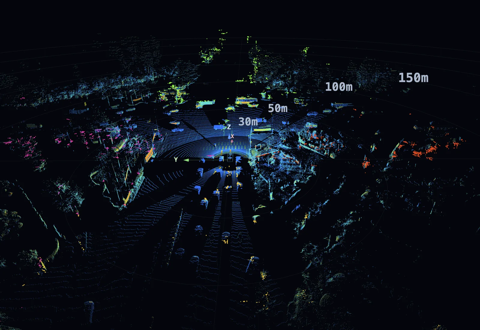
A production-ready dataset captured on real roads by AIR4D. Every sensor is synchronized and aligned, so you can evaluate, train, and simulate right away — no extra preprocessing.
02 — Drive
How the data is captured.
A dedicated collection system — the vehicle, the multi-sensor stack, an in-house logging tool, and precision time-sync infrastructure — engineered for data consistency and reliability.
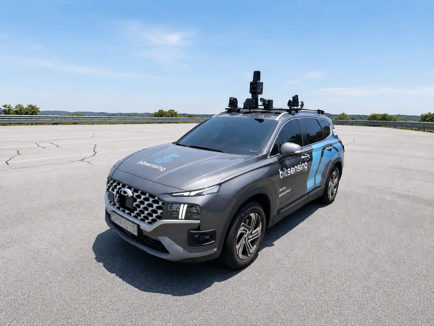
A multi-sensor stack purpose-built for autonomous vehicle (AV) perception.
A multi-modal system that captures 360° 4D Imaging Radar alongside LiDAR · Camera · GNSS/IMU. Every sensor is calibrated into a single coordinate frame, delivered ready to use with no alignment work on your side.
- Dedicated collection vehicle — roof-rack sensor mount · in-house onboard compute
- 360° 4D Imaging Radar × 4 · 3D LiDAR × 1 · Camera × 5 · GNSS/IMU × 1 (11 devices total)
- In-house logging tool — lossless local recording · raw and refined/synchronized data emitted together
- Dedicated PTP/gPTP sync infrastructure synchronizes every sensor to microsecond accuracy
03 — Studio
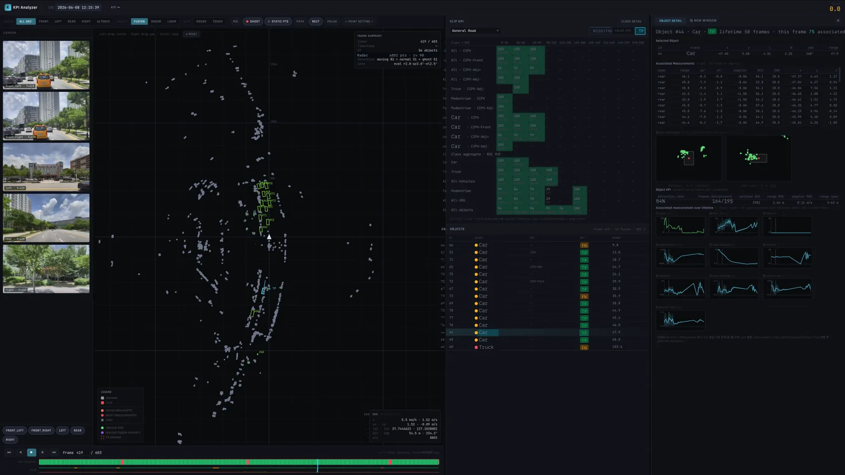
Continuous KPI evaluation that powers AIR4D.
Sensor-performance KPIs are computed and analyzed automatically across every dataset collected. It's the validation backbone that improves the next AIR4D quickly and consistently.
From raw capture to KPI dashboard.
- Automatic dataset ingest · sync · calibration consistency checks
- Automatic AIR4D performance KPIs — point cloud · tracking, and more
- Per-scenario dashboards · regression-trend monitoring · drift detection
- Need a collaboration built on this data and KPI infrastructure? Get in touch.
Imaging radar,
beyond the spec sheet.
Not a spec sheet — a 4D Imaging Radar that improves rapidly through real-road measurement and automated KPI evaluation. Whether you're assessing sensor performance, building perception models, or planning a validation program — let's talk.